|
|
|
Dates and Locations:
Mississauga Convention Center
Toronto, Ontario, Canada
September 1 & 2, 2010
|

|

|
|
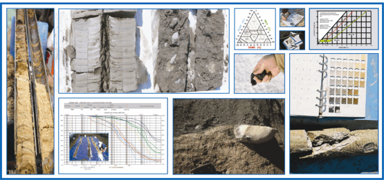
USCS: CL
|
USCS: CL
|
Same Classification, yet differ in Origin,
Distribution and Geotechnical Properties.
|
|

|
Continuing Education Information:
- Continuing Education Units (CEUs) and a Course Completion Certificate will be administered by Midwest GeoSciences Group
- Most state professional licensure programs accept CEUs for this course
|
Course Premise
Hydrogeologists and geotechnical engineers face a common problem: how do you take the mystery out of the subsurface at sites underlain by complex glacial sequences � sequences featuring deposits from successive glacial advances with interbedded stratified meltwater deposits occurring as isolated lenses within a glacial unit or as continuous stratified units between successive glacial advances?
For hydrogeologists, a key is knowing whether the various stratified meltwater deposits are contaminant pathways through continuous units underlying the site or if they are merely isolated lenses within a fine-grained glacial unit. Related questions include:
- Where should well screens be set to monitor a contaminant pathway?
- How can the stratigraphic sequence be identified so that groundwater flow patterns beneath the site can be characterized and understood?
The questions are no less challenging for geotechnical engineers. How can the stratigraphic sequence beneath the site be determined so that the effects of site stratigraphy on foundation conditions can be assessed?
- What is the stratigraphic sequence beneath the site?
- How do I successfully sample the sequence to determine foundation conditions, cut slope stability or soil borrow source characteristics?
Surficial weathering alters the geotechnical and hydrogeologic properties of glacial sediments. South of the Canadian Shield, where glacial deposits are derived from Paleozoic and younger sedimentary bedrock, distinctive weathering patterns and weathering zones develop from the surface downward.
Surficial soils develop from the land surface downward and are commonly 0.5 to 2 m (1.5 to 6 feet) thick. Alteration is so great that these surficial soils have a pervasive secondary soil structure that largely obliterates any primary sedimentary structure.
Beneath the surficial soils, weathering continues but is not as intensive, and a sequence of �weathering zones� develop. These zones are defined on the basis of
- Color-related oxidation state
- Carbonate status (leached or unleached)
- Presence of absence of jointing
The sequence and depth of these weathering zones indicate the nature and extent of the subsurface alteration that these deposits have undergone.
Weathering zones can be quickly and readily described using simple letter abbreviations, and are extremely important in depicting the weathering changes that have taken place to different units in the glacial succession.
Accompanying weathering is the development of secondary jointing: fractures that affect infiltration and sediment strength. Examination of fracture geometry indicates that they develop from desiccation. Although there is still much research to be completed, the desiccation process significantly affects the hydraulic conductivity of fine-grained glacial deposits.
What does taking the mystery out of complex subsurface conditions require? An understanding of glacial stratigraphy, glacial depositional environments, and the magnitude of any post-depositional weathering alteration.
This course provides techniques for identifying and understanding glacial stratigraphy and depositional environments. These techniques are based on an understanding of glacial depositional environments, glacial sedimentology, and regional glacial stratigraphy. Join us for this course and learn how to take the mystery out of the complex glacial sequences underlying your environmental and geotechnical sites.
|
Testimonials:
"This course is excellent. ....it should become the standard for logging in glacial soils."
- Tom George, Senior Geologist, URS Corporation
"An outstanding course; I highly recommend it. The classroom session provides a wealth of relevant information and techniques, and the field session reinforces the course concepts in the best way possible - in a practical, hands-on setting."
- Nick Bonow, Hydrogeologist and Engineer, McCain and Associates
"....the most relevant workshop I ever attended. A nice blend of academic theory applied to environmental practice."
- Sarah Finley, Indiana Department of Environmental Management
"The course gives a strong basis for description of glacial sediments and understanding of correlating geologic sequences."
- Alex Oiffer, Hydrogeologist, Worley Parsons, Inc.
"I have over 20 years of experience logging soil and rock core, and this course provided very valuable knowledge and insight for recognizing and writing meaningful soil and sediment descriptions. I highly recommend it for geologists, soil scientists and especially engineers."
- Jeffery Martin, Ohio Environmental Protection Agency
"The course topics provided an outstanding range of topics presented by experienced instructors. Excellent, comprehensive course."
- Melissa Swartz, Geological Survey of Ireland
"This course is a MUST for anyone working in glacial deposits. The instructors were knowledgeable, effective and friendly. I liked working with other participants, collaboratively. Field activities were practical, technical and integral to the course."
- Claire Milloy, WB Betty & Associates, Inc.
|
"This Course is excellent. It should be the standard for logging glacial soils."
-George Thomas, Senior Geologist, URS Corporation
Introduction:
Professionals will gain an advantage by improving the reliability, accuracty, and defensibility of hydrogeologic and geotechnical site characterization. Experience shows that the best site characterizations occur when field staff have up-to-date field analysis skills coupled with the ability to recognize and manage geologic uncertainties as they arise in the field, rather than waiting to evaluate site conditions in the office once the field work is complete. Complicated glaciated sites can be particularly difficult, however, because many field geologists have not had the opportunity to be trained with the latest concepts regarding glacial processes and midwestern glacial stratigraphy.
This workshop provides the necessary background to analyze complex glacial sequences, including:
- Recognition of contrasting sedimentary assemblages from subglacial, supraglacial, glaciofluvial, and glaciolacustrine environments
- Identification of post-depositional changes, particularly weathering zones
- Applied descriptive elements for glacial deposits and interpretation of depositional environments for environmental and engineering projects
- Methods to manage project budgets wisely by making informed field judgments
The description and characterization of glacial deposits is often complicated by the difficulty in determining the distribution, continuity, and geometries of geologic units. Upland glacial settings in the Midwestern United States and Canada are typically underlain by a sequence of fine-grained glacial sediments deposited by successive glacial advances. Stratified sand and gravels may occur at various stratigraphic positions within this fine-grained succession, depending on the history of glacial advances and on the resultant changes in depositional environments. Laterally extensive sand-and-gravel units, which constitute rational groundwater monitoring zones, are most likely to occur between the deposits of different glacial advances because this is the setting where widespread outwash deposition can take place; other sand-and-gravel units within the sequence tend to be discontinuous. The key to determining a suitable groundwater monitoring zone thus depends on the ability to determine the boundary between different glacial advances in these successions of primarily fine-grained deposits. Likewise, the key to determining the engineering properties of geologic units depends on the ability to map and predict the distribution of stratigraphic units.
Numerous factors to date have contributed to less than successful site characterization: inadequate training in glacial depositional environments and glacial stratigraphy, the sole reliance on the Unified Soil Classification for characterizing glacial deposits, and the usual method of analyzing data after the field work has been completed have resulted in site characterizations that rarely answer all of the questions about subsurface site conditions
Adequate training remains a problem. Meaningful understanding of modern glacial environments did not occur until the 1970's, and subsequently there has been a time lag not only in applying these concepts to understanding past glacial sequences here in the Midwest, but to teaching these concepts at the University level as well. Further, although most state geological surveys have made important advances in defining and characterizing glacial stratigraphic units and their distribution, few geology students receive any field training in glacial geology or any significant training in field recognition and differentiation of local or Midwestern glacial stratigraphic units.
There has been limited success in evaluating site geologic conditions using the Unified Soil Classification System (USCS) to characterize subsurface sediments. The USCS was developed primarily for foundation investigations, not hydrogeologic characterization, and it is based on particle-size and plasticity-related properties of the sediments. While these two properties are important for hydrogeologic and geotechnical evaluation, the USCS alone does not include evaluation of important properties necessary to identify and differentiate different glacial depositional environments or glacial stratigraphic units. To be useful for most site characterizations, the USCS needs to be supplemented with description of the properties necessary to identify site stratigraphic units and depositional environments, including primary sedimentary structure, contact relationships (and any associated sedimentary structures), weathering zones (oxidation state and carbonate status), and secondary fracturing.
Traditional site investigations involve office determination of a field scope, assignment of field staff and drilling contractor, a field investigation to carry out the project scope (usually completed in minimal time to minimize drilling subcontractor's costs), and evaluation of the field data after the field investigation has been completed. The problem with such a traditional approach is that most sites are more complex or at least different than that assumed when the project scope was determined in the office, and more often than not, once final office evaluation is begun, it becomes apparent that the original program was not adequate for characterizing the site hydrogeologic or geotechnical conditions.
The focus of the short course is to demonstrate practical applications that help answer common questions faced during site characterization:
- What implications do depositional environments and secondary weathering processes have on hydrogeologic and geotechnical site investigations? How can the effects be recognized and analyzed in the field?
- What does the glacial stratigraphic framework look like and what are the implications for characterization? How does a stacked sequence of multiple till units effect a project?
- What are the necessary descriptive elements for communicating our observations of depositional environments and the resulting stratigraphy?
- In a sequence of fine-grained glacial deposits with interbedded sand-and-gravel units, are sand-and-gravel bodies in the sequence discontinuous or laterally extensive? How do we ensure that monitoring wells are set in the same unit?
- What are the best methods for sampling glacial sequences?
The short course will demonstrate some of the ways in which these questions can be answered through understanding the processes which control the distribution of different glacial deposits aided by field methods that improve the accuracy of hydrogeologic and geotechnical data collection. Technology, drilling and sampling demonstrations conducted for the work shop will include several very useful site characterization methods.
 Sedimentary and stratigraphic analysis of glacial depositional environments of the 130 feet deep soil core during the most recent "Improving the Description and Characterization of Glacial Successions" course.
"This course is a MUST for anyone working in glacial deposits. The instructors were knowledgeable, effective and friendly. I liked working with other participants, collaboratively. Field activities were practical, technical and integral to the course."
-Claire Milloy, WB Betty & Associates, Inc.
Day One: Morning Classroom Sessions (Wednesday)
- Learn to recognize and characterize glacial depositional environments: subglacial, ice-marginal, ice-contact, and proglacial environments � and why it�s important
- Learn how to differentiate deposits from a succession of multiple glacial advances, and why its critical for a meaningful site conceptual model
- Quaternary stratigraphy: unraveling the complexity, scale and context of site-specific sequences
- Recognize and understand the implications of weathering zones and secondary joint features
- Learn what conditions are necessary for ground water to move laterally (not vertically) through fine-grained glacial deposits
- Characterize hydrogeology of glacial deposits, characterize the geotechnical properties of glacial deposits
- Improve sediment descriptions on boring logs to characterize the geologic framework
Day One: Afternoon Classroom Sessions (Wednesday)
- Learn the basics and advances for recognizing secondary weathering and related effects weathering zones and alteration of primary depositional properties
- Fractures in glacigenic fine-grained sediments: subglacial shear, ice-contact faulting, vertical jointing, and natural and man-induced fracturing (river and lake bluff lines, excavations, etc.)
- Preliminary observations on vertical jointing in Quaternary deposits: geometry, origin, significance
- Discover the regional glacial framework and how the on-site boring relates to the regional setting
- Recent trends and advances in 3D geologic modeling while dealing with certainties and uncertainties
- Learn how to classify sediments in the field using the Unified Soil Classification System (USCS) and the modified USCS (in Canada) among contrasting other classification systems
- Learn to make your company�s boring logs: accurate, complete, credible and provide critical context for project success
Day Two: Morning Field Exercises (Thursday)
- Learn the field-proven process to �think on your feet� and the benefits of analyzing data in the field to reduce mistakes and create appreciable efficiences
- Examine the on-site deposits and learn to recognize sequences from multiple glacial advances
- Learn field recognition of a weathering zone
- Practice classifying and describing sediments to improve boring log descriptions
- Observe recent Rotasonic and Direct Push updates
- Improve field characterization skills for accurate well placement and geotechnical testing
Day Two: Afternoon Field Exercises (Thursday)
- Provide rationale for geotechnical sampling and testing that is related to site stratigraphy instead of a random and whimsical sampling approach
- Learn the importance of characterizing ground water movement through fine-grained units
- Apply new understanding of hydrogeology of glacial deposits
- Key elements of boring log information
- Mechanics of field analysis and recognition of unexpected subsurface conditions
- Assess field data for proper well placement and geotechnical testing
- Learn to manage project budgets wisely by making informed field judgments
Registration Information:
Advanced registration is necessary for participation in this limited-enrollment short course. Pre-registration is required to reserve space and receive course materials. A minimum of 25 people must be registered at the early registration deadline to conduct any short course, but please note this course normally reaches maximum capacity a few weeks before the early registration deadline.
Special arrangements for diet, equipment, or handicap facilities should be indicated when registering for the course.
What you will receive:
You will receive 16.0 contact hours of instruction, a Field Guide for Soil and Stratigraphic Analysis, a USDA Soil Texturing Field Flow Chart, a comprehensive 200-page course notebook with many reference resources and a CEU completion certificate from Midwest GeoSciences Group. Registration also includes continental breakfast, morning coffee break, lunch, and an afternoon break. Recording devices are not permitted during classroom sessions.
|
FREE with your Course Registration
|

|

|
|
Field Guide for Soil and Stratigraphic Ananlysis
|
USDA Soil Texturing Field Flow Chart
|
These field guides are field-proven to help you think on your feet in the field.
|
Cancellations:
Cancellations may be made up to two weeks before the course, however, 25 percent of the course fee will be charged. Cancellations made after two weeks before the course will be charged $400. No refunds. One substitute is allowed for each registrant who is unable to attend. Other policies may apply.
Cost:
Register Now: $780 (USD)
Register after 20 August 2010: $980 (USD)
Register Now ONE-DAY Course: $500 (USD)
A group discount of 20% may be applied when five or more people from the same company register at the same time during the early registration period.
Government discounts available, please inquire at 763.607.0092. Student discounts are available for students with full-time enrollment verification.
Tim Kemmis, PhD, PG, AECOM
Carolyn Eyles, PhD, McMaster University
Dan Kelleher, PG, CIPM, Midwest GeoSciences Group
 Tim Kemmis is internationally-recognized for his work in glacial sedimentology and stratigraphy. For most of the time since 1992, Tim has worked as a senior geologist consultant and project manager for large-scale hydrogeologic investigations. However his unique experience as both an applied researcher and consultant has allows Tim to effectively unravel sedimentary complexities coupled with his personal ability to teach these concepts to all staff levels.
Tim worked 14 years for the Iowa Geological Survey, during which he received his Ph.D., and where he:
- Carried out numerous glacial sedimentologic investigations
- Remapped the Des Moines Glacial lobe
- Established the formal glacial stratigraphy for the lobe based on depositional environments
- Discovered a new type of hummocky glacial topography
- Determined the geometry and origin of jointing in glacial tills
- Developed a lithofacies code to decipher the history of glacial outwash and alluvial sequences
Tim will be teaching course sessions dedicated to the environmental and engineering relationships between glacial depositional processes and the resulting stratigraphy coupled with how they may be described and characterized on professional boring logs. Tim will also be addressing how secondary weathering plays an important role for understanding water table occurrence and ground water movement in near-surface fine grained sediments such as glacial till.
 Carolyn Eyles is internationally-recognized for her applied research in glacial sedimentology. She is currently a professor at McMaster University in Hamilton, Ontario where she teaches advanced glacial sedimentology courses.
Carolyn�s extensive experience in glacial sediments allows unique access to learning from her about glacial processes control subsurface heterogeneities or uniformities. Carolyn�s long list of publications are widely referenced among both academics and professionals doing work in glaciated areas.
Carolyn will be teaching course sessions dedicated to reconstructing and depicting the regional glacial framework along with three-dimensional mapping of glacial sequence stratigraphy for application to environmental and engineering projects.
In 2009, Carolyn was awarded the 3M National Teaching Fellow by 3M Canada and The Teaching and Learning in Higher Education in recognition for her teaching and research achievements.
http://www.science.mcmaster.ca/geo/faculty/eyles_c/index.html
 Dan Kelleher is a hydrogeologist dedicated to unraveling the complexities of glacial successions for ground water and geotechnical projects. Dan promotes field analysis during stratigraphic characterization from boring to boring in order to utilize QA/QC processes fully throughout a project and help identify unexpected conditions as soon as they arise.
Dan�s technical expertise is quantitative hydrogeology (in porous and fractured media), geotechnical analysis of sedimentary sequences, aquifer testing and predictive ground water modeling.
Dan teaches the important steps for using the USCS, modified USCS (in Canada) combined with boring log descriptive elements that help make you logs complete, accurate, credible and provide applied context. He will contrast the USCS (used commonly in the US) and the modified USCS (used commonly in Canada) along with contrasting other common classification systems. He will address descriptive elements for characterizing various glacial deposits and their scale of distribution.

HOLIDAY INN EXPRESS AND SUITES
40 Admiral Boulevard
Mississauga, Ontario L5T 2W1
Phone: 905.795.1011
(located 2 blocks from Mississauga Convention Center)
Refer to �Midwest GeoSciences Group� to access discounted room rate of $120/night.
Note: Many hotels are located within walking distance of the Mississauga Convention Center.
http://www..mississaugaconvention.com/HotelListing.pdf
|
|
Become A Member
It's Free, It's Easy and as a
Member you'll enjoy...
- Exclusive Videos
- Special Pricing
- And Much More
|
|
Join
|
Learn More
|
Association of Environmental
& Engineering Geologists
|