INTRODUCTION TO LITHOFACIES CODES:
with Application to 3D Mapping
- What are lithofacies codes?
- How and why were lithofacies codes developed?
- Why are they important?
Lithofacies codes are a universal texture-based classification that is independent from geologic environment, although it leads into facies analysis and depositional processes. Lithofacies terms and codes are becoming more common for consultants working in glaciated area and are having a positive impact on defining complex site stratigraphy.
This webinar is an introduction to lithofacies codes and is designed for geoprofessionals who are interested in learning about lithofacies codes and how they are applied to hydrogeological and geotechnical investigations.
Learn a new way to effectively define and characterize
sedimentary sequences.
We will begin with introducing the concept of lithofacies codes, including the lithofacies codes schemes for braided stream deposits and glaciogenic sediments. The coding of lithofacies associations, or architectural elements, will be presented from a historical perspective with reference to primarily fluvial lithofacies codes (Miall, 1978, Eyles et al., 1983, Kemmis, 1984, and Benn and Evans, 1998).

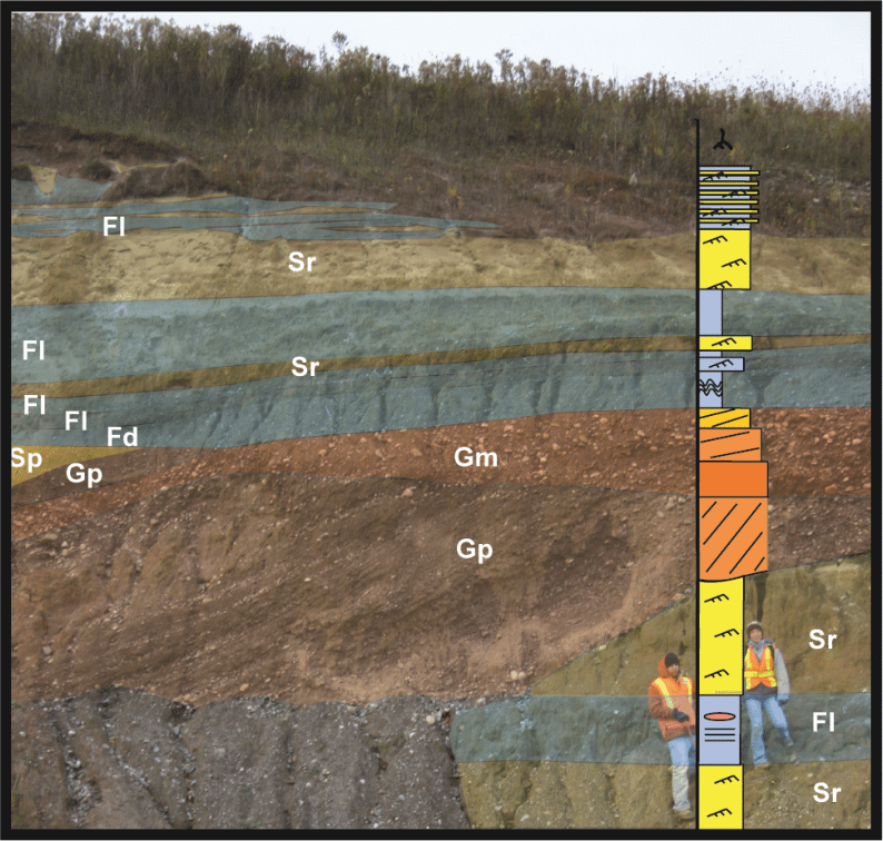
Modified from Slomka & Eyles (2013)
Webinar Highlights:
- Introduction to the concept of lithofacies codes, including the foundational lithofacies code schemes for fluvial and glacial sediments.
- Introductory exploration of how lithofacies codes are modified to hydrofacies codes for hydrostratigraphic characterization.
- Brief overview of how lithofacies codes may be used as an input for object-based and geostatistical modeling.
Gain an Advantage from this Webinar by:
- Discovering the power of lithofacies codes, and how they are applied to fluvial and glacial sediments.
- Learn how lithofacies codes may be translated to hydrofacies codes.
- Learn how lithofacies codes may be used to communicate and simplify geological descriptions in vertical logs and 2D images.
- Learn how lithofacies codes may be used as input parameters for object-based and geostatistical modeling.
Instructors Bio
Jessica Slomka, PhD, PGeo
 Jessica Slomka, PhD is passionate about sedimentology and especially about glacial sediments. She completed her Ph.D. at McMaster University in 2014 in the School of Geography and Earth Sciences. Her doctoral work focused on characterizing the sedimentary architecture of glacial sediments in modern and ancient deposits, including a modern ice margin in Iceland.
Jessica (prefers Jess) is a registered P.Geo (APEGA) and worked as a geologist at the Alberta Geological Survey/Alberta Energy Regulator (AGS/AER) in the Subsurface Geological Framework section for three years. At the AGS, Jess worked on characterizing the glacial stratigraphy in the Peace River area as part of a multi-year project. Jess also collaborated with her colleague, G. Hartman, to characterize the sedimentology and architecture of the Grimshaw gravels, which hosts a major aquifer for communities in north-central Alberta. During her time at the AGS, Jess volunteered with the Alberta Science Network conducting classroom visits as part of the Rocks & Minerals unit, and is currently completing a graduate program at the Ontario Institute for Studies in Education (University of Toronto).