
THE USE AND MISUSE OF THE UNIFIED SOIL CLASSIFICATION SYSTEM:
Understanding Soil Classification in the Field
Learn how accurate soil classifications and other descriptive elements are essential for:
- Well screen design and placement
- Preparation of reliable potentiometric surface maps
- Ground water monitoring system design
- Excavation and foundation design.
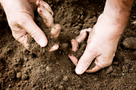
Soil classification is fundamental for geotechnical and environmental site characterization, and the Unified Soil Classification System (USCS) is the classification used in North America. Unfortunately, the industry's state-of-practice overlooks simple improvements to make the classification a useful characterization tool and often misuses the classification in site evaluation.
This 90-minute webinar begins with a brief historical perspective of the USCS followed by the step-wise procedures for classifying both coarse- and fine-grained sediments. Helpful tips are presented to make field classification easier and less confusing as well as to make the classification a better characterization tool by adding supplementary grain-size information, depositional environment interpretation, and site-stratigraphic unit information. Common ways the classification is misused are pointed out with helpful solutions.
This webinar will cover the following topics:
- Background of the USCS
- Coarse-Grained vs. Fine-Grained Sediments
- Laboratory Methods vs. Field Classification Techniques
- Particle Size Curves and how to understand them
- Poorly-Graded vs. Well-Graded
- Understand the Coefficient of Uniformity and the Coefficient of Curvature
- Lean Clay vs. Fat Clay vs. Silt
- Plasticity Chart and how it applies to fine-grained sediments
- Common mistakes and confusing terms.
- How the USCS applies to building the geologic framework, and how it doesn't.
- A simple Case Study that illustrates stratigraphic context for soil classification.
| Fee: |
299.00 USD Per Computer Site (unlimited participants per site).
|
| Instructor |
Tim Kemmis, Ph.D., P.G.
|
| Handouts: |
Copy of Webinar Slides (pdf)
Record of Attendance Form (pdf)
|
| Duration: |
1.5 hours plus Q&A
(no restrictions on time limit for extra Q&A!)
|
Professional
Development: |
Earn 1.5 Professional Development Hours (1.5 PDH)
 |
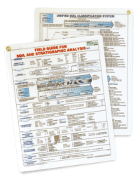 Register before December 04, 2012 and receive a free
FIELD GUIDE FOR SOIL AND STRATIGRPAHIC ANALYSIS
for each site.
Additional copies may be purchased for the discounted price of $10.
A Record of Attendance Form is included free with each webinar for your record keeping and individual PDH verification. We ask your on-site coordinator to return the completed and signed copy of the Form to us following the webinar for (1) maintaining a separate copy as a service to attendees and (2) forwarding to NIU confirming attendance for those who order certificates.
Attendees may also order an official a Course Completion Certificate from Northern Illinois University for a small administrative fee. The Certificate is optional and may be ordered separately following the webinar to confirm your attendance and showcase the certificate on your office wall. Instructions for ordering certificates are given during the webinar.

* This webinar is eligible for the 'BUY THREE, GET THREE' discount.
Attendees will be invited to actively participate during this live and interactive on-line web seminar. Discussion is planned following the webinar for those who want to continue the session. Bring your questions to the webinar and present them to the instructor and other participants for exploring the best solution.
Instructor Bio
Tim J. Kemmis, PhD, PG
Senior Geologist Consultant and Project Manager
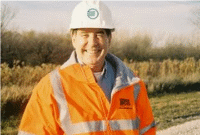 Tim Kemmis works as a senior geologist consultant and project manager for large-scale hydrogeologic investigations. His unique experience as both an applied researcher and consultant has enabled Tim to effectively teach staff at all levels how unravel sedimentary complexities by making fundamentally sound observations, preparing complete and accurate boring logs and confidently correlating geologic units.
Tim received his bachelor's degree in agricultural soil science from the University of Illinois and his master's degree in glacial geology while working as a graduate assistant at the Illinois State Geological Survey.
He worked 14 years for the Iowa Geological Survey, during which he received his Ph.D., and where he:
- Carried out glacial sedimentologic investigations
- Remapped the Des Moines Glacial lobe
- Established the formal glacial stratigraphy for the lobe based on depositional environments
- Discovered a new type of hummocky glacial topography
- Determined the geometry and origin of jointing in glacial tills
- Developed a lithofacies code to decipher the history of glacial outwash and alluvial sequences
Tim is a co-founder of Midwest GeoSciences Group and has successfully taught many courses and webinars dedicated to improving boring logs and helping geologists think on their feet.
 Questions? Email us at service@midwestgeo.com or call 763.607.0092
Webinar Topic Suggestion: Click Here


