This course helps apply Environmental Sequence Stratigraphy to your sites. It builds on the principles of Environmental Sequence Stratigraphy and continues with methods to achieve a holistic understanding of hydrogeologic relationships.
Environmental Sequence Stratigraphy (USEPA, 2017) is a relatively new application of Sequence Stratigraphy to environmental projects. Sequence Stratigraphy is a proven method used mainly in petroleum exploration for mapping coarse- and fine-grained sediment loads by reconstructing sedimentary basin fill processes into individual sequences of deposition related to sediment supply and accommodation.
One premise of Environmental Sequence Stratigraphy is that coarse-grained portions of a heterogeneous aquifers conduct the majority of ground water flow and contaminant migration.
An advantage of Environmental Sequence Stratigraphy is that it is a phased-based approach for discerning aquifer heterogeneity. Stratigraphers leverage existing data collected from soil boring logs, geophysical logs, and/or Cone Penetrometer Testing to recognize vertical trends of grain size distribution and then correlate those patterns into sedimentary facies models. Those models are then used to design ground water monitoring points and remedial action plans.
There are certain challenges in implementing Environmental Sequence Stratigraphy. Despite the proven reliability of Environmental Sequence Stratigraphy for discerning aquifer heterogeneity, the method requires training in Sequence Stratigraphy. Applying ESS requires a basic understanding of depositional processes and the ability to put soil boring observations in the context of depositional environments, processes, stratigraphy, and subsurface relationships.
Some obvious challenges exist, such as ensuring subsurface data is accurate and complete. One problem is that soil classifications and the inferred grain-size data on soil boring logs may not conform to standards, resulting in erroneous stratigraphic interpretation.
Some less obvious challenges exist not only Environmental Sequence Stratigraphy, but also in our hydrogeologic work when it comes to modern problem solving. This course teaches critical strategies to measure "certainty vs uncertainty" in ground water and contaminant movement.
There are no short cuts for establishing the stratigraphic framework.
Strategies for deciphering depositional environments are fundamental to taking the mystery out of the subsurface. But the fundamentals for translating the story the sediments are telling onto soil boring logs remains a challenge. The fall-out from incomplete and/or inaccurate soil boring logs coupled with the financial need to perform work faster has favored High-Resolution Site Characterization (HRSC). HRSC measurements are fast, reproducible and include a manageable procedural analysis. However, subsurface complexities may demand more than just HRSC measurements alone to understand subsurface relationships.
We strive toward a holistic hydrogeologic approach that not only considers the nature of sedimentary sequences, but also post-depositional alterations such as weathering. Examining the entire ground water flow regime allows confidence in prioritizing data gaps, managing uncertainties, and analyzing aquitard integrity. The benefit is greater certainty for understanding ground water flow paths as well as contaminant migration, fate and transport, and receptors.
This course begins by introducing hydrogeologic principles related to Environmental Sequence Stratigraphy and subsurface investigations. It continues with steps for implementing both Environmental Sequence Stratigraphy and other common approaches to defining and characterizing the subsurface. The course builds on this foundation by demonstrating the merits of Environmental Sequence Stratigraphy. It presents step-wise strategies for different regional depositional systems to help participants synthesize the role of stratigraphy and holistic hydrogeology at environmental sites.
How we simply define geologic units at a site plays a huge role in our ability to unravel site complexities and build the stratigraphic sequence.
This course reveals unspoken challenges and unveils solutions for making sense of hydrogeologic relationships.
COURSE PRE-REQUISITE:
It will be helpful to have a basic understanding of three references:
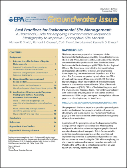
(1) USEPA, 2017, Best Practices for Environmental Site Management: A Practical Guide for Applying Environmental Sequence Stratigraphy to Improve Conceptual Site Models; Washington, DC, EPA/600/R-17/293, September 2017. A pdf of the guide (62-pages) can be downloaded at: https://cfpub.epa.gov/si/si_public_record_report.cfm?dirEntryId=341373&Lab=NRMRL
(2) USEPA, 2020, Webinar: An Overview of the Fundamentals of Sequence Stratigraphy and its Application to Developing Robust Conceptual Site Models and Remedial Strategies, presented by J. Sadeque, and R. Samuels on January 15, 2020 for USEPA Clu-in (Contaminated Site Clean-up Information). A pdf of the PowerPoint slides and the session audio can be downloaded at: https://clu-in.org/conf/tio/DCHWS4_011520/
(3) Chamberlin, T.C., 1890, Method of Multiple Working Hypotheses; pp. 754-759, Published by: American Association for the Advancement of Science. Abbreviated Reprint: Science, Vol. 148, No. 3671. Available online at https://www.whoi.edu/cms/files/chamberlin65sci_72744.pdf
BENEFITS OF ENVIRONMENTAL SEQUENCE STRATIGRAPHY:
Environmental Sequence Stratigraphy and facies models benefit groundwater remediation projects by improving the ability to:
Interpret lateral continuity between borehole data and correlate site data in three dimensions;
Identify groundwater flow paths and preferential contaminant migration pathways;
Map and predict contaminant mass transport (high permeability) and matrix diffusion related storage (low permeability) zones;
Identify data gaps and assess the need and cost benefit of high resolution site characterization;
Determine appropriate locations and screen intervals for monitoring and remediation wells, and;
Improve efficiency of remediating and monitoring of contaminated groundwater.
(Source: USEPA, 2017).
COURSE APPLICATION:
Application of Environmental Sequence Stratigraphy is proven to improve Conceptual Site Models (CSM) and provide a basis for stratigraphic relationships, groundwater flux, and associated contaminant transport.
This course helps apply Environmental Sequence Stratigraphy to your sites. It builds on the principles of Environmental Sequence Stratigraphy and continues with methods to achieve a holistic understanding of hydrogeologic relationships.
Ground water monitoring and remediation design efficiencies are dependent on understanding holistic ground water flow regimes through stratigraphic relationships and effects of post-depositional alterations.
Participants will learn what questions that should be asked - and answered - during a hydrogeologic investigation conducted using Environmental Sequence Stratigraphy.
Drilling and sampling strategies and work process is a key component to implementing Environmental Sequence Stratigraphy. This course presents some methods that both simplify and maximize subsurface information for unraveling stratigraphic complexities.
This online course is not a primer for learning Sequence Stratigraphy.
Live or On-Demand Course Modules at Your Own Pace.
The personalized experience allows each registrant to learn (1) at their own experience level, (2) at their own pace, and (3) and in a private setting except when they have questions or request extra tutorials.
Take your time and dive deep into this course experience.
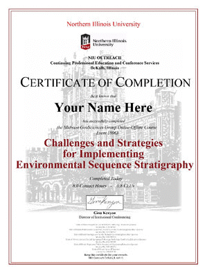
Final Exam and CEU Certificate
The course concludes with a Final Exam. Options for an additional tutorial is available and each registrant receives an official CEU Certificate from Northern Illinois University showing 8.0 Contact Hours.
Register Now for this unique online course that demystifies the stratigraphic relationships to ground water monitoring and contaminant transport.
THIS COURSE INCLUDES: • Pre-Course Prerequisite Materials • Self-Assessment • Three LIVE (or On-Demand) course modules • Offline Tutorial Activities • Final Exam • CE Certificate from Northern Illinois University (for 8.0 Contact Hours)
CHALLENGES AND STRATEGIES FOR IMPLEMENTING ENVIRONMENTAL SEQUENCE STRATIGRAPHY ONLINE COURSE
PRE-COURSE PREPARATION:
Self-Assessment
Take the general, 10-question self-assessment of basic course concepts. Refrain looking up answers, just assess yourself. Submit your test at completion. Individual results will not be shared.
Watch the course modules for the explanation and details for answers. If you want to discuss the answers following any course module, contact Dan Kelleher at dan@midwestgeo.com to schedule a time together.
Record of Attendance and Continuing Education Units
A free Record of Attendance Form is included with each course module. Complete a form for each module for your own use. Witness signatures are not required for most PG and PE licensure renewals related to continuing education (check the requirements for your license).
A Final Exam is administered on an individual basis, following completion of all three course modules and the tutorials. The course is approved for 8.0 Contact Hours (0.8 CEU) by Northern Illinois University.
Northern Illinois University administers the Course Completion Certificate based on the date a participant completes the Final Exam. NIU distributes the CEU Certificate that is suitable for framing.
Accessing the Live Online Course Modules (Using the Portal)
Emails with access instructions are sent to participants within a week of each live course module. Emails include links to the Adobe Connect platform and to broadcast slides and record of attendance forms.
Make sure to allow emails from support@midwestgeo.com to your email system.
If you (intentionally or un-intentionally) miss a live session, there is a follow up email with instructions for accessing the on-demand version of the course module. Terms and Conditions exist, electronic sharing of any kind is prohibited.
Self-Assessments, reference content, tutorials, and recommended resources are accessible using the Online Course Portal. Portal access is provided following registration.
Course Module One sets the stage for understanding both the challenges and strategies for implementing Environmental Sequence Stratigraphy (ESS). The USEPA (2017) has designated ESS as a preferred approach to site investigations and the development of Conceptual Site Models (CSMs). There's good reason for this. And that reason is the complexity and uniqueness geology has to offer. Nature has a seemingly infinite number of variables. The result? We encounter geologic sequences with complex geometries and relationships both laterally and vertically. Environmental Sequence Stratigraphy is a successful approach toward understanding those complexities.
This course module introduces the three phases of Environmental Sequence Stratigraphy investigations identified in the USEPA's Best Practices for Environmental Site Management: A Practical Guide for Applying Environmental Sequence Stratigraphy to Improve Conceptional Models:
Phase 1 - Understand the Site Setting using available information to determine the geologic setting, applicable depositional environment(s), and the characteristics/relationships of the expected geologic sequences.
Phase 2 - Format the lithologic data and determine how trends relate to the depositional environment(s) and the geologic sequence history. If existing data are inadequate, complete any additional subsurface investigation needed to clarify facies, depositional environments, and the site sequence stratigraphy.
Phase 3 - Identify and map the subsurface geologic sequence stratigraphy with respect to depositional environment and predict contaminant pathways. Test and refine predictions (from well data, ground water chemistry, etc.).
This Course Module continues with discussion of the challenges that have historically inhibited reliable subsurface investigations and describes the essential information required to implement Environmental Sequence Stratigraphy. This module includes:
The importance of the ESS approach in providing the information to understand geologic relationships (geometries) in the subsurface, enabling construction of accurate Conceptual Site Models (CSMs).
The merits and misuse of other common investigative approaches and how they compare to ESS.
Basic essentials needed to implement ESS:
T.C. Chamberlin's Method of Multiple Working Hypotheses.
Recognition of the contaminant characteristics of the contaminants of concern.
Knowing and understanding depositional environments and facies.
Completing appropriate sampling.
Classifying and describing the sediment sequence to reveal depositional environments, facies, and sediment characteristics and relationships.
Course Module Two begins with a discussion of the three steps - or phases - in Environmental Sequence Stratigraphic investigations.
The ESS approach differs somewhat between different depositional environments, so we will briefly discuss three different depositional environments and the types of complexity and variability found in them:
Coastal plain marine environments
Alluvial environments
Glacial environments.
For each of these depositional environments, we will discuss various questions that our investigations need to answer as we complete each phase of the ESS investigation. Some starting points are listed below:
Phase 1 - Understand the site setting: location in the regional geologic setting, geomorphic position of the site, expected depositional environments/processes/deposits, potential lateral facies changes and relationships, regional geologic history and its significance to changing depositional environments/processes/deposits through time.
Phase 2 - Put the site information into a geologic context by formatting the lithologic data so that depositional environments, facies, and lateral and vertical relationships (geometries) can be identified in order to predict ground water flow through the sediment system.
Phase 3 - Test that the geologic framework established by Environmental Sequence Stratigraphic Analysis accurately predicts ground water and contaminant flow.
This phased approach enables establishment of the site sequence stratigraphy and initial predictions of ground water movement, contaminant migration, and receptor vulnerability. The next course module will conclude with methodology to incorporate low-permeability aquitards integrity and their impact within the site-scale system.
[The on-demand webinar above is free with this course registration. Instructions for accessing it are given to each registrant, terms and conditions apply]
DISCUSSION:
Environmental Sequence Stratigraphy investigations tend to be focused on aquifers, yet aquitards occur in almost every sedimentary sequence. Even so, little study has been made of just how effective aquitards actually are at particular sites.
Course Module 3 discusses the role and hydrogeologic effectiveness of aquitards in sedimentary sequences. For example, weathering and the hydrogeologic changes it can cause to sediments, particularly in the development of joints (fractures) in fine-grained sediments can dramatically impact bulk hydraulic conductivities, both near surface and where weathering zones are buried by younger sediments.
This course module presents basic strategies for testing aquitard integrity. It also includes a list of common practices that are generally not a reliable indicator of actual aquitard effectiveness, aspects not typically included in boring log descriptions or indicated in geophysical investigations. The module will include how aquitard integrity relates to basic hydrogeologic principles of hydraulic gradients and flow mechanisms.
In order to help participants understand the nature of how aquitards can become jointed and fractured, this module will discuss the basics of post-depositional weathering processes. Weathering is generally not covered in geologic and engineering courses, but weathering changes sediment properties, in particular, the development of jointing (fractures) in fine-grained sediment.
This module also features a case study of an alluvial sequence to demonstrate the importance of Phase 1 investigations of the regional geologic background in order to understand the unexpected alluvial sequence that was encountered.
Post depositional weathering and hydrogeologic changes within Sedimentary Sequences.
Holistic Hydrogeology: considering the entire ground water flow system.
Hydraulic Gradients and Implications for Monitoring
Low-permeability aquitards:
Differentiating stacked aquitards.
Measuring aquitard integrity.
Application of the ESS approach to sediments deposited in an alluvial environment.
Conclusions
Main Take-Away Points and Offline Tutorial Guidance.
Re-Visiting the Fundamental Questions and Answers for Implementing ESS.
Where do we go from here?
Following Course Module 3, participants are eligible for taking the Final Exam and receiving a course completion certificate from Northern Illinois University.
OFFLINE COURSE TUTORIALS:
Study Notes and Tutorials (1.0 Hour)
Completion of tutorials are part of this course. The tutorials will be distributed approximately 1 week before the first course module using a Online Course Portal. Time estimated to complete the material is 1+ hour, however 0.5 instructional contact hours are assigned by NIU to this exercise along with a Final Exam.
FINAL EXAM:
Final Exam:
The final exam is an online series of course element challenges that include both basic aspects of Environmental Sequence Stratigraphy and hydrogeologic principles.
25 Multiple Choice Questions
Graduation:
Private and individualized commencement to receive a Continuing Education Certificate from Northern Illinois University Outreach for 8.0 Professional Development Hours (0.8 CEU).


 One premise of Environmental Sequence Stratigraphy is that coarse-grained portions of a heterogeneous aquifers conduct the majority of ground water flow and contaminant migration.
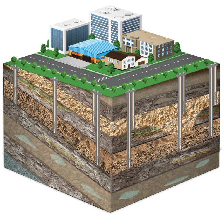
 Take the general, 10-question self-assessment of basic course concepts. Refrain looking up answers, just assess yourself. Submit your test at completion. Individual results will not be shared.